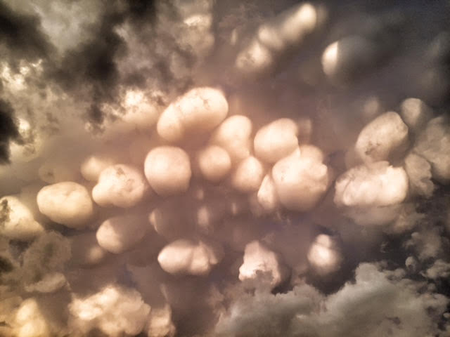
click on the pouches to enlarge
Remember that unusual cloud formation I posted yesterday? My pal Six-Deuce saw it on Facebook and notified me that these are called Mammatus Clouds.
They are pouch-like cloud structures and a
rare example of clouds in sinking air. They are also most often associated with
anvil clouds and severe thunderstorms. They often extend from the base of a
cumulonimbus. They usually
form after the worst of a thunderstorm has passed.
According to the University of Illinois the science is as follows: Updrafts carry precipitation enriched air to the cloud top, upward momentum is
lost and the air begins to spread out horizontally, becoming a part of the
anvil cloud. Because of its high concentration of precipitation particles (ice
crystals and water droplets), the saturated air is heavier than the surrounding
air and sinks back towards the earth. The
temperature of the subsiding air increases as it descends. However, since heat
energy is required to melt and evaporate the precipitation particles contained
within the sinking air, the warming produced by the sinking motion is quickly
used up in the evaporation of precipitation particles. If more energy is
required for evaporation than is generated by the subsidence, the sinking air
will be cooler than its surroundings and will continue to sink downward.
Contrary to common knowledge they do not
indicate an imminent tornado (although they do look ominous). Mammatus can be a remarkable sight, especially when
sunlight is reflected off of them. Rare. No wonder nobody has seen these before. Cool.


No comments:
Post a Comment